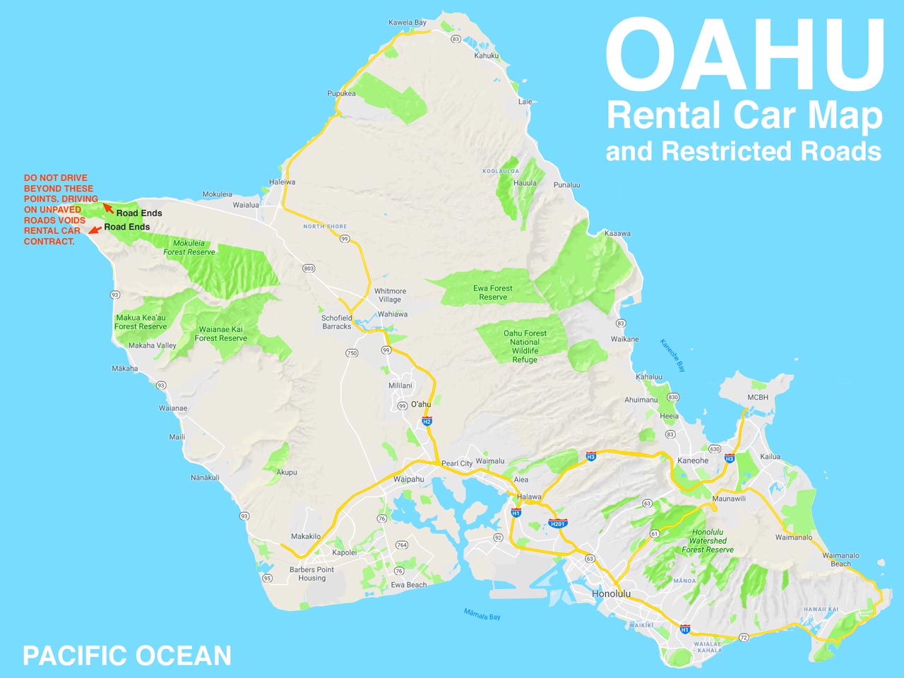
 The good news. You are basically free to explore the entire island. There are only two roads which are listed as restricted for the majority of auto rental agencies: 808 Smart Car Rentals, Advantage Rent a Car, Alamo, Avis, Budget, Cheap Rent a Car, Dollar, Enterprise, Hertz, JN Rentals, Little Hawaii Rent a Car, Lucky Owl Car Rental, National, Payless, and Thrifty. View this map of Oahu Island.
USE THIS OAHU CAR RENTAL MAP TO YOUR BENEFIT
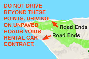
The road to the north is Farrington Hwy and the rent-a-car agencies want you to stop or turn-around at the parking lot and trailhead for Kaena Point Trail. Please check the website for trail conditions if you are planning to hike the Kaʻena Point Trail from the north or the west.
On the west side, also at the end of a portion of Farrington Hwy, is Kaena Point. The road turns to dirt and mud where the pavement ends. While this unpaved road was once accessible by vehicle, the road is no longer open to auto traffic. You can turn around at the lot or park and explore this beautiful area on foot.
As we just made the point, do take advantage of the area which is closed to most vehicles. It’s a peaceful location to explore after parking your car or Jeep at the end of the road. Bring clothing to keep warm as the winds can be quite strong at Kaena Point. Make sure to lock your vehicle. Transfer any valuables to your trunk before you arrive to park. It’s always better to be safe than sorry.